
Climate Shift Index Alert•October 9, 2026
Climate change supercharged the warm Gulf waters fueling Hurricane Isaias
October 9, 2026
Isaias underwent rapid intensification in the western Gulf of Mexico between October 7 and 8, strengthening from a tropical storm to a hurricane. By Friday, October 9, the storm rapidly intensified again, strengthening to a Category 3 hurricane. Isaias is moving over exceptionally warm Gulf of Mexico waters and is forecast to make landfall on the Gulf Coast between Alabama and Florida late Friday, October 9.
The exceptionally warm, record sea surface temperatures fueling this storm across the western and central Gulf of Mexico are up to 600 times more likely due to human-caused climate change. The waters over which Isaias formed before becoming a named storm were up to 800 times more likely. These warm waters significantly enhance the storm’s potential strength.
According to the National Hurricane Center, life-threatening storm surge is expected along portions of the Gulf Coast, from the mouth of the Mississippi River to Suwannee, Florida. Damaging hurricane-force winds are expected across parts of the Florida Panhandle, southern Alabama, and southern Mississippi, with gusts possibly extending farther inland. Heavy rainfall is expected across the central Gulf Coast and much of the Southeast through the weekend.
According to the Storm Prediction Center, tornadoes are possible across the Florida Panhandle, southeast Alabama, and southwest Georgia on Friday afternoon and night as the hurricane’s outer rainbands spread inland, extending into parts of the Carolinas on Saturday evening.
Find frequently updated information about how climate change may impact this storm at Isaias and climate change.
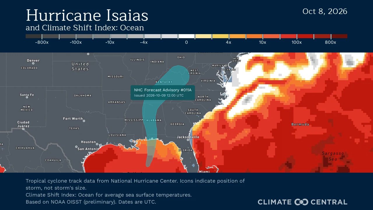
Note: This is NOT a storm forecast. Visit the National Hurricane Center for the latest updates and information on how the storm is evolving.
How is climate change influencing this storm?
Isaias underwent rapid intensification over waters that were 1.4°C (2.4°F) warmer on average than they would have been in a world without climate change. These unusually warm Gulf waters, exceeding 31°C (88°F), were made 4 to 600 times more likely due to human-caused climate change.
The Gulf’s warmer oceans supercharge tropical systems’ ability to carry moisture, adding to the ongoing flood concerns, especially across southern Alabama, the Florida Panhandle and Big Bend, and southwest Georgia through the weekend.
Isaias could bring a substantial storm surge to the Gulf Coast. Human-caused climate change has raised sea levels in this region by about 6.5 inches since 1900, allowing storm surges to reach higher levels and increase their potential for destruction.
Climate change is forecast to add 7 mph to Isaias's maximum sustained wind speeds.
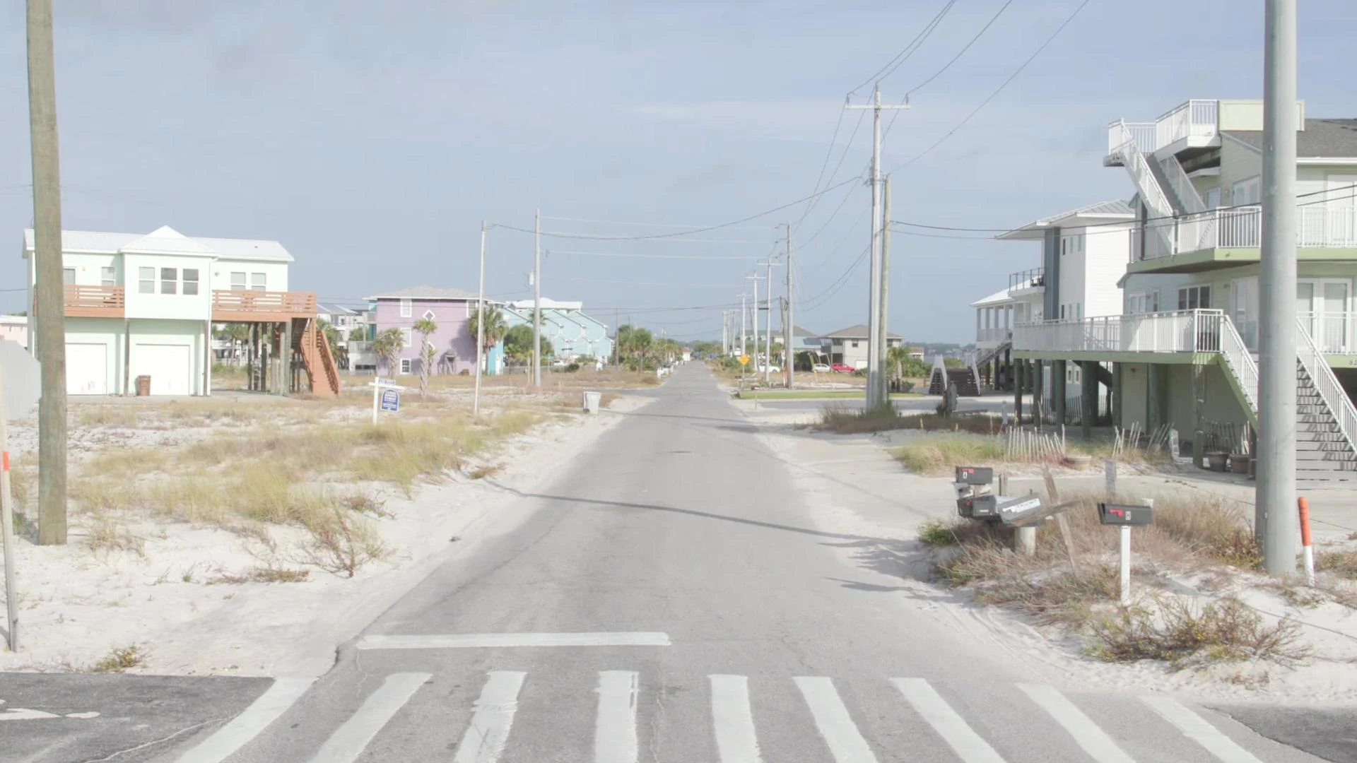
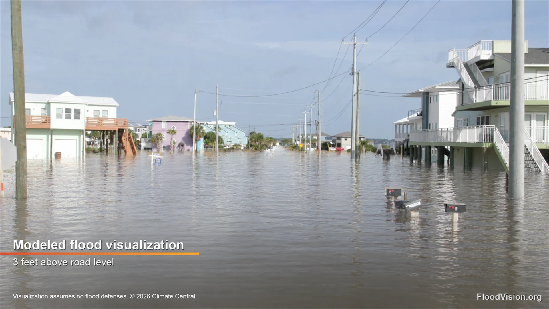
This FloodVision® modeled visualization uses scans from our vehicle’s previous drive along Gulf Blvd in Navarre Beach, Florida, to illustrate potential Hurricane Isaias storm surge flooding with water 3 feet above road level, informed by NHC’s forecast. This is a modeled scenario, not actual flooding or an exact forecast. Flooding could exceed the 3 feet shown here, with even higher levels possible elsewhere along the coast. Follow local officials’ guidance. Climate change is raising sea levels, giving storm surge a higher starting point. NHC forecast issued October 9, 2026, at 10 a.m. CDT. Visualization by Climate Central FloodVision® About these visualizations · National Hurricane Center .
What do experts say?
Dr. Daniel Gilford, Meteorologist and Climate Scientist at Climate Central, said:
"The first hurricane of the season clearly shows the fingerprints of climate change. Climate-warmed Gulf waters mean that Isaias is forecast to be 7 mph stronger than it would have been in a world without heat-trapping carbon pollution, increasing the chances of expensive and life-threatening consequences for Gulf coast communities."
To request an interview with a Climate Central expert, please contact Abbie Veitch at aveitch@climatecentral.com.
How do we know climate change is influencing this heat?
The Climate Shift Index: Tropical Cyclones (Tropical Cyclone CSI) is grounded in peer-reviewed methodology and high-quality data. It quantifies the impact of human-caused climate change on a storm's intensity.
The Tropical Cyclone CSI calculates the increase (or decrease) in a storm’s wind speeds because of climate change-warmed ocean waters and tropical climate warming.
This system is built on the foundation of our Climate Shift Index: Ocean (Ocean CSI) tool, which shows daily sea surface temperatures across the globe and quantifies how human-caused climate change has increased (or decreased) the likelihood of those temperatures.