
Climate Matters•May 20, 2026•Reuse this content
Summer Warming (1970-2025) Driven By Climate Change
KEY FACTS
Meteorological summer starts June 1, and the season is heating up across the U.S.
Summers have warmed since 1970 in 97% of 243 U.S. cities analyzed.
A new Climate Central analysis shows that human-caused climate change is the leading driver of summer warming trends in 221 (91%) of these cities.
Nearly every city analyzed now experiences more hotter-than-normal summer days than during the early 1970s — 22 more such days, on average.
Hotter summers can amplify urban heat and lead to heat-related illness, higher energy bills, and worse wildfire risk.
This Climate Matters analysis is based on open-access data from the National Oceanic and Atmospheric Administration (NOAA). See Methodology for details.
Learn More:
Data explorer:
Hotter summers can lead to heat illness, higher energy bills, and worse wildfire risk
Like all other seasons, summer is getting warmer across the U.S. as heat-trapping pollution continues to warm the planet.
Hotter summers bring more frequent and intense extreme heat — a serious health hazard. Heat is the leading cause of weather-related deaths in the U.S. and heat risks can intensify in cities due to the urban heat island effect.
Hotter summers can also increase wildfire risk, lead to higher energy bills from air conditioning, and further amplify urban heat.
Explore summer reporting resources covering these and other effects of warming summers.
Climate Central analyzed average summer (June, July, August) temperature data from 243 major U.S. cities and quantified the influence of human-caused climate change on each city’s warming trend from 1970 to 2025. See Methodology for details.
Summers are getting hotter in 97% of U.S. cities analyzed
Summer warming has been widespread. Summer temperatures warmed in 97% (236) of the 243 U.S. cities analyzed.
From 1970 to 2025, summer warmed by 2.6°F on average across these 236 cities.
On average, summer has warmed the most in cities across the western and southern U.S., led by the Northwest (3.8°F), Southwest (3.7°F), and South (3.0°F).
The top five summer warming locations were: Reno, NV (11.3°F); Boise, ID (6.3°F); El Paso, TX (6.3°F); Las Vegas, NV (6.2°F); and Salt Lake City, UT (6.0°F).

Climate change is driving summer warming trends in most U.S. cities
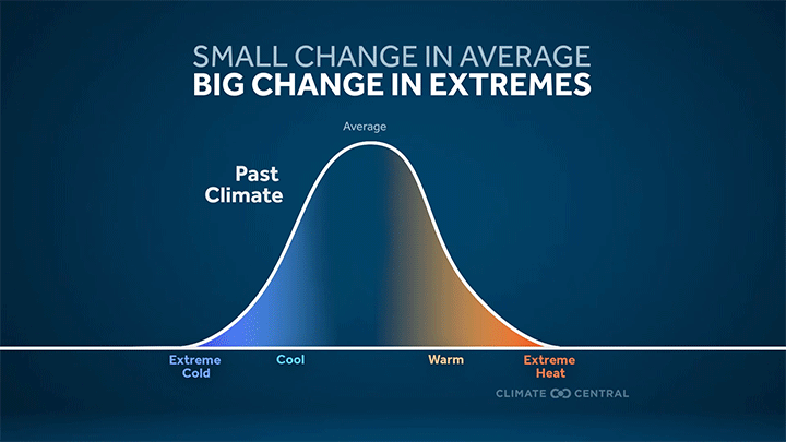
New attribution science analysis used Climate Central’s Climate Shift Index to directly assess the influence of human-caused climate change on summer warming trends in the same 243 U.S. cities since 1970 (see Methodology for details). Results of this analysis show that summer warming is mostly human-caused.
In most cities analyzed (91%, or 221 cities), human-caused climate change was the leading cause of summer warming — accounting for at least 50% of observed warming since 1970.
Secondary drivers of summer warming include natural climate variability (for example, the El Niño-Southern Oscillation), the urban heat island effect, and other unresolved processes (for example, weather station relocations since 1970).
Human-caused climate change is mainly due to the heat-trapping carbon pollution that results from burning fossil fuels for transportation, electricity, heating and cooling, and more.
Download data for all 243 cities to see the influence of climate change on summer warming near you.

More unusually hot summer days
The warming season is also reflected in the growing number of summer days that are hotter than normal based on local temperatures in each of the 243 cities during 1991-2020.
Nearly every city analyzed (96%, or 234) now experiences more hotter-than-normal summer days than during the early 1970s — 22 more such days, on average.
The rise in hotter-than-normal summer days was largest among cities in the Southwest (31 more days on average), South (29 more days on average), and Southeast (27 more days on average).
The cities with the largest increase in hotter-than-normal summer days since 1970 were: Reno, NV (68 more days); Houston, TX (58 more days); Albany, GA (55 more days); and Las Cruces, NM and New Orleans, LA (both 53 more days).

Summer Reporting Resources #


Hotter summers can…
Bring more dangerous heat. Extreme heat — the leading cause of weather-related deaths in the U.S. — is a growing health risk in our warming climate. A record 2,325 people died from heat in the U.S. in 2023 alone. Exposure to extreme daytime heat and sweltering nights makes it difficult for our bodies to cool off, resulting in heat-related illnesses including heat cramps, heat exhaustion, and life-threatening medical emergencies such as heat stroke. Heat is dangerous for everyone. But some groups —including children, pregnant people, and outdoor workers — face a higher risk of heat-related illness than others. Extreme heat is even more dangerous when combined with high humidity.
Amplify urban heat. The entire planet is warming due to human-caused climate change, but the built environment further amplifies both average temperatures and extreme heat in cities. During extreme heat events, the urban heat island effect can worsen heat stress and related illness for millions, put vulnerable populations at risk, and lead to higher energy bills and strained power grids during spikes in cooling demand.
Lead to higher energy bills. Longer, hotter summers also bring higher demand for indoor cooling. Annual cooling degree days—a measure of cooling demand—have increased since 1970 in 97% U.S. cities analyzed by Climate Central. Keeping schools cool during the back-to-school period is a growing challenge, especially for schools in urban heat islands. When air conditioners run later into the year, energy costs and heat-trapping emissions both increase.
Make summer recreation riskier. The national parks are more popular than ever, and visits tend to peak during summer. Within continued warming, the 25 most-visited national parks are likely to experience nearly five times more extremely hot days per year by 2050, compared to the recent past. More extreme heat in national parks and other recreation areas puts ecosystems and millions of visitors at risk.
Boost wildfire risk. Hotter summers can worsen wildfire risk. The frequency of hot, dry, windy fire weather is growing — particularly in the western U.S. A longer wildfire season puts health and safety at risk. Wildfire smoke exposure in the U.S. has surged to record levels over the last five years, and tends to spike during late summer and fall.
Worsen air quality. Summer heat can worsen air quality by trapping harmful pollutants close to the Earth’s surface and fueling the formation of ground-level ozone. These pollutants can exacerbate respiratory health issues in people with asthma and other lung diseases. Children are among the most vulnerable to the health impacts from air pollution, and exposure (especially to wildfire smoke) can have significant, life-long impacts.
LOCAL STORY ANGLES
Is climate change influencing daily heat extremes in your local area?
Climate Central’s Climate Shift Index system provides tools, data, custom maps, and local alerts to answer this question in real-time. Here are three ways to use the Climate Shift Index this summer:
Use the tools. Climate Central’s Climate Shift Index map tools — which now include both temperature and humid heat — shows which parts of the world are experiencing high Climate Shift Index levels, every day.
Access KML files to create custom Climate Shift Index maps. Fill out this form to receive CSI maps in KML format, and create custom Climate Shift Index maps.
Sign up for alerts. Sign up here to receive custom email alerts when strong Climate Shift Index levels are detected in your local area.
How is extreme heat affecting public health in your local area?
The National Integrated Heat Health Information System HEAT.gov is a hub for information to support heat resilience in the U.S. Check out HeatRisk, an interactive map tool from the National Weather Service now available for the contiguous U.S. This color-numeric index shows current and forecast risk of daily local heat-related impacts. The CDC’s Heat and Health Tracker maps daily rates of heat-related illnesses across the U.S.
What local measures are in place to protect people from heat?
The EPA maintains a Heat Island Community Actions Database of measures that communities are taking to mitigate local heat island effects. Reports from NOAA’s urban heat island mapping campaigns cover local risk reduction and adaptation strategies in 60+ U.S. cities. Track local climate-related hazards, including extreme heat, using the Climate Mapping for Resilience and Adaptation Portal, which also includes federal resources for long-term resilience planning. The NIHHIS provides heat preparedness and planning resources, including many resources in Spanish.
CONTACT EXPERTS
To request an interview with a Climate Central expert about this analysis, please contact Abbie Veitch, aveitch@climatecentral.org.
FIND EXPERTS
Submit a request to SciLine from the American Association for the Advancement of Science or to the Climate Data Concierge from Columbia University. These free services rapidly connect journalists to relevant scientific experts.
Browse maps of climate experts and services at regional NOAA, USDA, and Department of the Interior offices.
Explore databases such as 500 Women Scientists, BIPOC Climate and Energy Justice PhDs, and Diverse Sources to find and amplify diverse expert voices.
Reach out to your State Climate Office or the nearest Land-Grant University to connect with scientists, educators, and extension staff in your local area.
METHODOLOGY
Average temperatures and days above normal were calculated for each meteorological summer (June, July, August) from 1970 to 2025 using data obtained from the Applied Climate Information System (ACIS), which is developed, maintained, and operated by NOAA’s Regional Climate Centers. Summer days above normal are defined as the number of days with average temperatures above the most recent 30-year (1991-2020) NOAA/NCEI climate normals.
The map of the continental U.S. shows the change in average summer temperatures by county since 1970 with data from NOAA/NCEI’s Climate at a Glance. Note that data for Connecticut is displayed by county because NCEI data are not yet available for Connecticut’s planning regions. Hawaii is not included as data is not available before 1991.
Climate Central's local analyses typically include data for 247 U.S. weather stations. For reported data summaries based on linear regression, however, only 243 stations are included in this brief due to data completeness measures that were not met by four stations: Bend, OR; Hazard, KY; Jefferson City, MO; and Twin Falls, ID.
Out of these 243 stations, 236 (97%) have a positive trend in summer temperatures from 1970 to 2025 (i.e., a linear regression slope greater than zero). These 236 stations have experienced summer warming since 1970.
To estimate the influence of human-caused climate change on summer warming trends (1970-2025) in each city, we used Climate Central's Climate Shift Index system to compare two statistical models of summer temperature distributions (fit to ERA5 data): one calibrated to today's climate (with ~1.3°C of global warming above pre-industrial levels) and one representing a world without human-caused warming (0°C above pre-industrial levels). The difference between these two modeled temperature distributions is the expected summer warming attributable to human-caused climate change.
We then compared the observed summer warming since 1970 based on weather station data (ACIS) to the expected summer warming due to human-caused climate change. The difference between these two values represents the influence of a range of secondary drivers of seasonal temperature trends.
Human-caused climate change reflects the accumulation of heat-trapping greenhouse gases in the atmosphere due to human activities.
Secondary drivers of summer temperature trends include natural climate variability, observational noise (from weather station data collection), and the urban heat island effect.
Dividing the expected summer warming due to human-caused climate change by the observed summer warming results provides the percentage of observed warming due to human-caused climate change.
Human-caused climate change was the leading cause of summer warming — accounting for at least 50% of observed warming since 1970 — in 221 (91%) of the 243 stations included in this analysis. In these 221 cities, the expected warming due to climate change is greater than the net effect of a range of secondary drivers of summer warming trends.
Data for individual locations is available in the full data file.
Climate Matters © 2026 by Climate Central is licensed under CC BY 4.0
This license grants permission to use, distribute, and reproduce all text, graphics, and multimedia content published on this page in any medium, provided that Climate Central is credited per the CC BY 4.0 license.
Permission to use data and other materials published on this page is granted for non-commercial uses, commercial news purposes, and educational purposes as governed by Climate Central's Terms of Use.