
Climate Matters•December 3, 2014•Reuse this content
Winter Precipitation Trends
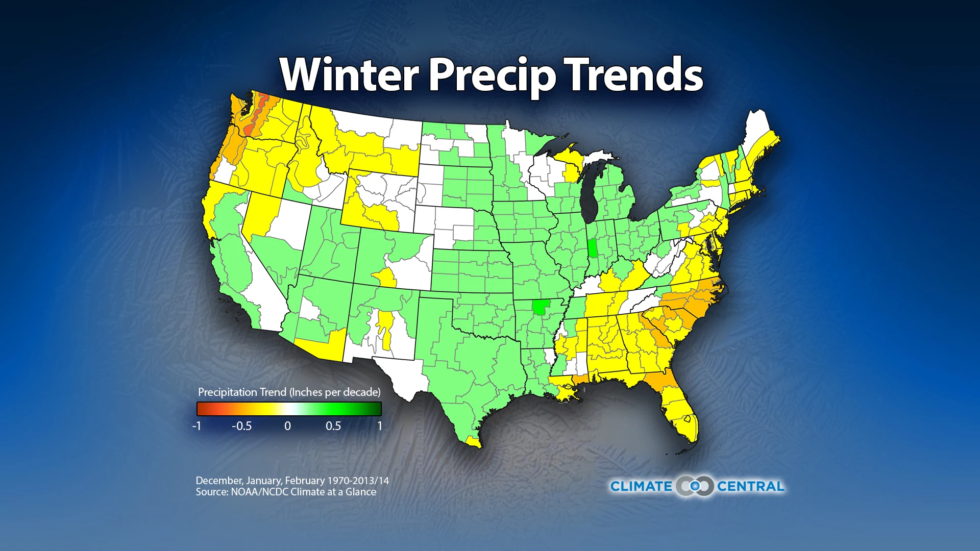

We’re less than three weeks from the start of astronomical winter, but this week marks the start of meteorological winter. That makes it a good time to look at trends in winter temperatures and precipitation.
Over the past 40 years or so, the planet has warmed considerably under its growing blanket of human-generated greenhouse gases. Winters in the continental U.S. have warmed as well — by 2.4°F since 1970, on average, which is .54°F per decade. That is just an average, though. When you zoom in to the regional level, some places have warmed faster and some slower.When it comes to precipitation, it’s more of a mixed picture. The Southeast and Northwest have gotten somewhat drier over that same period, while the Ohio Valley has gotten wetter. Interestingly, considering the current drought afflicting California, the longer trend shows that winters across most of that state have gotten wetter. For the Northeast, it’s a mixture of wetter and drier depending on exactly where you look.
Climate Matters © 2014 by Climate Central is licensed under CC BY 4.0
This license grants permission to use, distribute, and reproduce all text, graphics, and multimedia content published on this page in any medium, provided that Climate Central is credited per the CC BY 4.0 license.
Permission to use data and other materials published on this page is granted for non-commercial uses, commercial news purposes, and educational purposes as governed by Climate Central's Terms of Use.