
Climate Matters•May 31, 2016•Reuse this content
Hurricane Season Preview

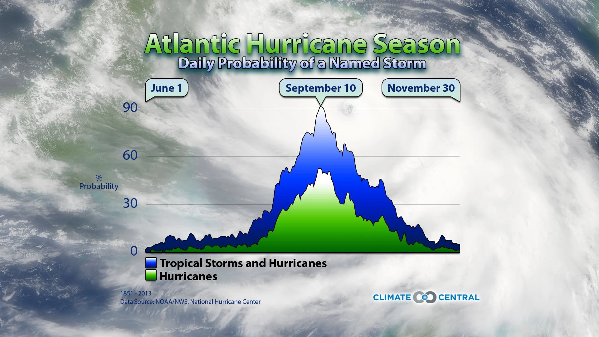
June 1 is the first day of meteorological summer and the first day of the Atlantic hurricane season. More than 10 years have passed since a major hurricane made landfall in the U.S. Wilma was the last, hitting Florida in October 2005. This abnormally quiet period continued last season, as 2015’s strong El Niño likely suppressed the activity of the season.
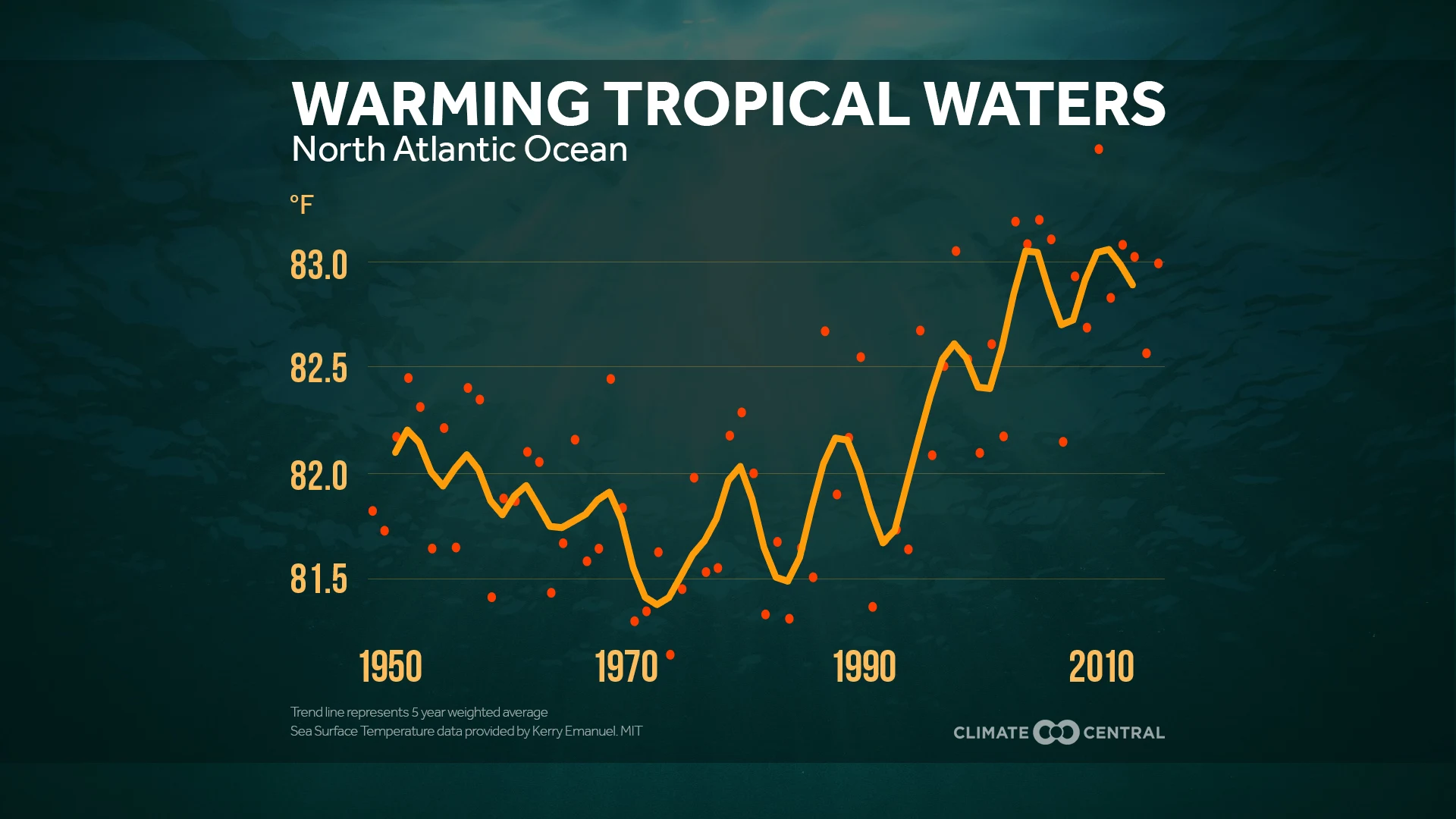
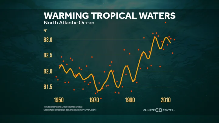
There are several factors in hurricane development, including wind shear and dry air in the middle atmosphere, but sea surface temperature is critical. Warmer water means more evaporation, providing more fuel for the storm’s development. Over the last century, the planet’s oceans have warmed, in some locations, as much as 1-3°F. And while there are long term fluctuations in the Atlantic Ocean’s temperature, there has been a distinct upward trend since 1970.
Rising sea levels will make any landfalling storm more destructive. Higher sea levels allow storm surge to penetrate farther inland, meaning flood damage will increase even if hurricanes do not get any stronger. Acknowledging the destructive nature of storm surge, the National Hurricane Center will begin issuing storm surge forecasts for landfalling this hurricane season. Visit our Surging Seas interactive to see how rising sea levels impact your favorite part of the coast.
FEWER BUT STRONGER
As the climate changes, tropical cyclones are expected to produce more rain and the frequency of the highest intensity storms is projected to increase even though the overall number of storms may remain unchanged or perhaps even decrease.
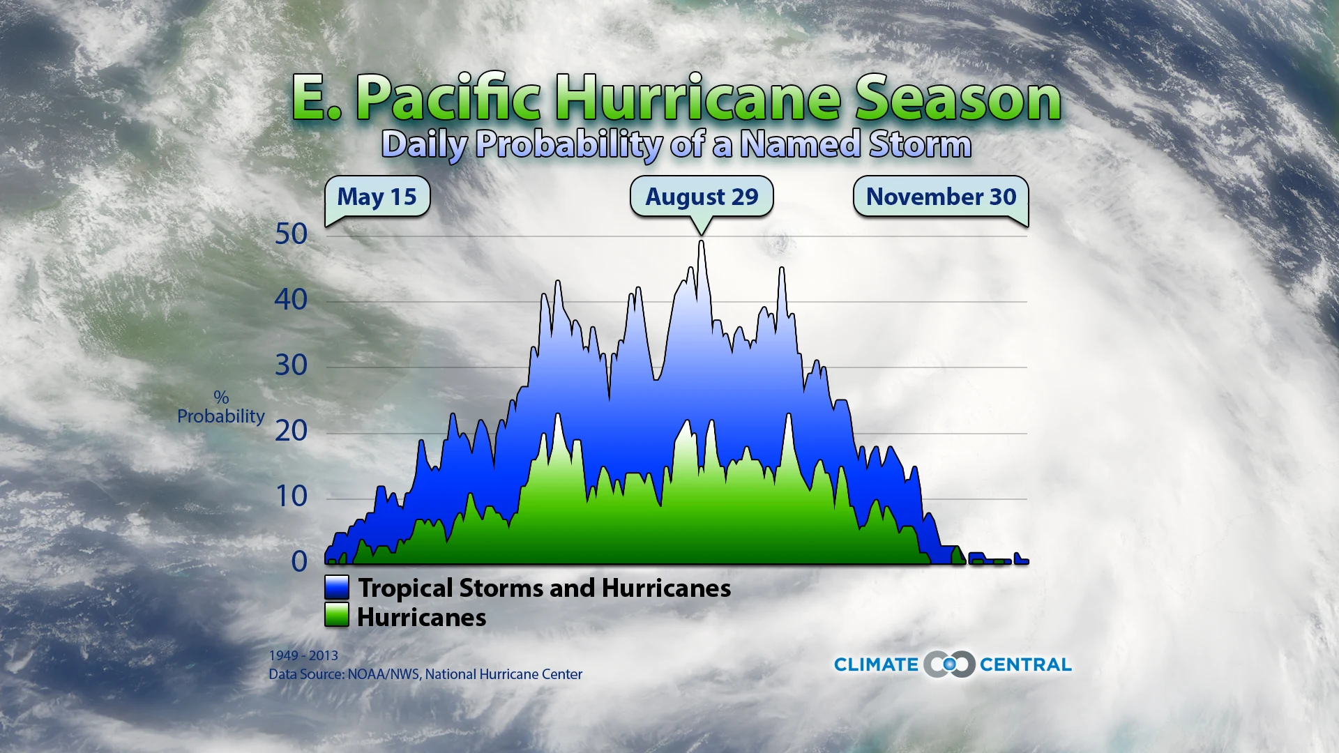
lthough June 1 marks the beginning of the Atlantic Hurricane Season, the Eastern Pacific season is already underway. But the peak of both seasons does not come until early fall, when the ocean is warmest
Climate Matters © 2016 by Climate Central is licensed under CC BY 4.0
This license grants permission to use, distribute, and reproduce all text, graphics, and multimedia content published on this page in any medium, provided that Climate Central is credited per the CC BY 4.0 license.
Permission to use data and other materials published on this page is granted for non-commercial uses, commercial news purposes, and educational purposes as governed by Climate Central's Terms of Use.