
News•July 13, 2014
Long Wait Continues as El Niño Lagging
The months-long wait for El Niño continues: The latest update from the Climate Prediction Center, issued Thursday, finds that conditions still aren’t quite in place to declare a full-blown El Niño, though forecasters still expect one to emerge by the fall. If and when it does, it is expected to impact weather and climate across the world and could push 2014 or 2015 to be the hottest year on record.
Animation of subsurface temperature anomalies in the tropical Pacific Ocean.
Credit: NOAA.
While the atmospheric characteristics that indicate an El Niño have been evident intermittently, they have yet to firmly take hold. Ocean surface temperatures have also fluctuated, though there is still considerable heat below the surface to fuel an El Niño, said Michelle L’Heureux, a CPC meteorologist who helps put together the monthly outlooks.
The update, issued in conjunction with the International Research Institute for Climate and Society at Columbia University’s Earth Institute, kept the chances of an El Niño being in place by later this summer and by fall to early winter at about the same as last month, 70 percent and 80 percent, respectively.
“So we’re still expecting and we’re still confident there will be an El Niño,” L’Heureux told Climate Central.RELATEDHow Will We Know When El Niño Finally Arrives?
El Niño Expected to Limit 2014 Hurricane Season
The Rise of El Niño in 1 Swell Image
El Niño is a periodic climate phenomenon that is part of the larger El Niño-Southern Oscillation, which includes its counterpart La Niña. El Niño is characterized by warmer-than-average temperatures in the eastern and central tropical Pacific Ocean (La Niña by cooler-than-average). This abnormally warm pool of water alters atmospheric flow patterns, which in turn can affect weather thousands of miles away. El Niños tend to lead to conditions that quash the formation of tropical storms and hurricanes in the Atlantic Ocean basin, for example.
While other areas of the globe see impacts from El Niño in spring and summer, the main effects of El Niño in the U.S. emerge in the colder months.
“The core of the impacts is in that November-March timeframe,” L’Heureux said. “That’s when things really start cranking over the U.S.”
Global temperatures are also typically higher during El Niño years. Combined with the warming effects of accumulating greenhouse gases in Earth’s atmosphere that have contributed to most of the 10 warmest years on record occurring in 21st century, this El Niño event could boost 2014 or 2015 to the top of the list. Four of the five warmest El Niño years have happened since 1998, the last major El Niño event.
The difficulty in recognizing whether an El Niño has emerged when looking month-to-month is that the phenomenon is best seen in a longer-term average — three months is the standard used by the CPC. And the thresholds used to declare an El Niño can differ between forecasting agencies, with the CPC using slightly different criteria than Australia’s Bureau of Meteorology.
“There are no iron-clad thresholds,” L’Heureux said. “There’s no on-and-off switch.”
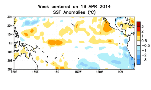
One of the indicators the CPC looks at to declare an El Niño Advisory, their term for when El Niño conditions are in place or expected to continue, is the sea surface temperatures in a particular part of the equatorial Pacific, which must be 0.5°C (0.9°F) above normal.
Over the past month, temperatures have been hovering around this mark, but the story deeper in the ocean has been more mixed, though there’s still an amply supply of warm waters to fuel an El Niño, L’Heureux said.
Winds over the tropical Pacific have also been flirting with an El Niño pattern. But “they’re not persisting, they’re not consistent,” L’Heureux said.
The atmospheric patterns are not like they were when forecasters were watching for an El Niño in 2012, when the pattern fizzled. Then, while ocean temperatures were warm, the atmosphere looked closer to its state during a La Niña, when the normal trade winds are ramped up.
Right now, the CPC forecasting team — made up of experts in different areas, from the ocean to modeling — are watching various indicators and measurements from the tropical Pacific and looking to tease out the “complex interplay between the ocean and the atmosphere,” L’Heureux said.
They still expect the El Niño to emerge during the Northern Hemisphere summer, though they have widened the range of possible strengths the event could have, favoring a weak to moderate one.
Overall, though, L’Heureux said, “We’re waiting, we’re just waiting.”
You May Also Like
1,001 Blistering Future Summers
Measuring Cow & Pig Emissions Goes to New Heights
New CO2 Milestone: 3 Months Above 400 PPM
Map Shows When Summer Heat Peaks in Your Town