
News•March 12, 2020
New Coastal Risk Screening Tool Supports Sea Level Rise and Flood Mapping by Year, Water Level, and Elevation Dataset
March 12, 2020
Climate Central today announced the release of its global Coastal Risk Screening Tool to generate customizable, localized maps of projected sea level rise and coastal flood risks by year, water level, and elevation.
Climate Central’s new mapping tool enables users to explore risks over time, for any coastal location in the world, incorporating multiple pollution scenarios, leading sea level rise models, and the most accurate available elevation data available—including Climate Central’s new CoastalDEM® elevation data for areas outside the United States. Coastal Risk Screening Tool users begin their exploration with three map choices:
YEAR
The year map allows users to explore coastal flood risk and sea level rise projections by decadal year.
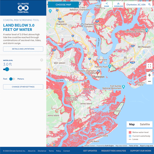
WATER LEVEL
The water level map allows users to explore what land is at risk from specific water levels (decimal feet, meters) that could be reached through combinations of sea level rise, tides, and storm surge.
ELEVATION DATASET
The elevation data map highlights how Climate Central’s improved elevation data indicates far greater global threats from sea level rise and coastal flooding than previously thought, and thus greater benefits from reducing their causes.