
Climate Central Breakthrough Redraws Coastal Flood Maps
Sea levels are rising, and more than a billion people live in coastal lowlands worldwide. But until recently, critical information for understanding and addressing this threat was missing. City planners, aid organizations, climate negotiators and everyone else lacked accurate data in most countries on something very basic: the height of the land beneath people's feet.
In fact, leading researchers from academia to the World Bank were using data that inflated coastal elevations by a global average of more than six feet (two meters), making flood threats look small compared to reality. The data were based on satellite sensors that could not tell treetops or rooftops apart from bare earth.
Then, in late 2019, Climate Central redrew the map.
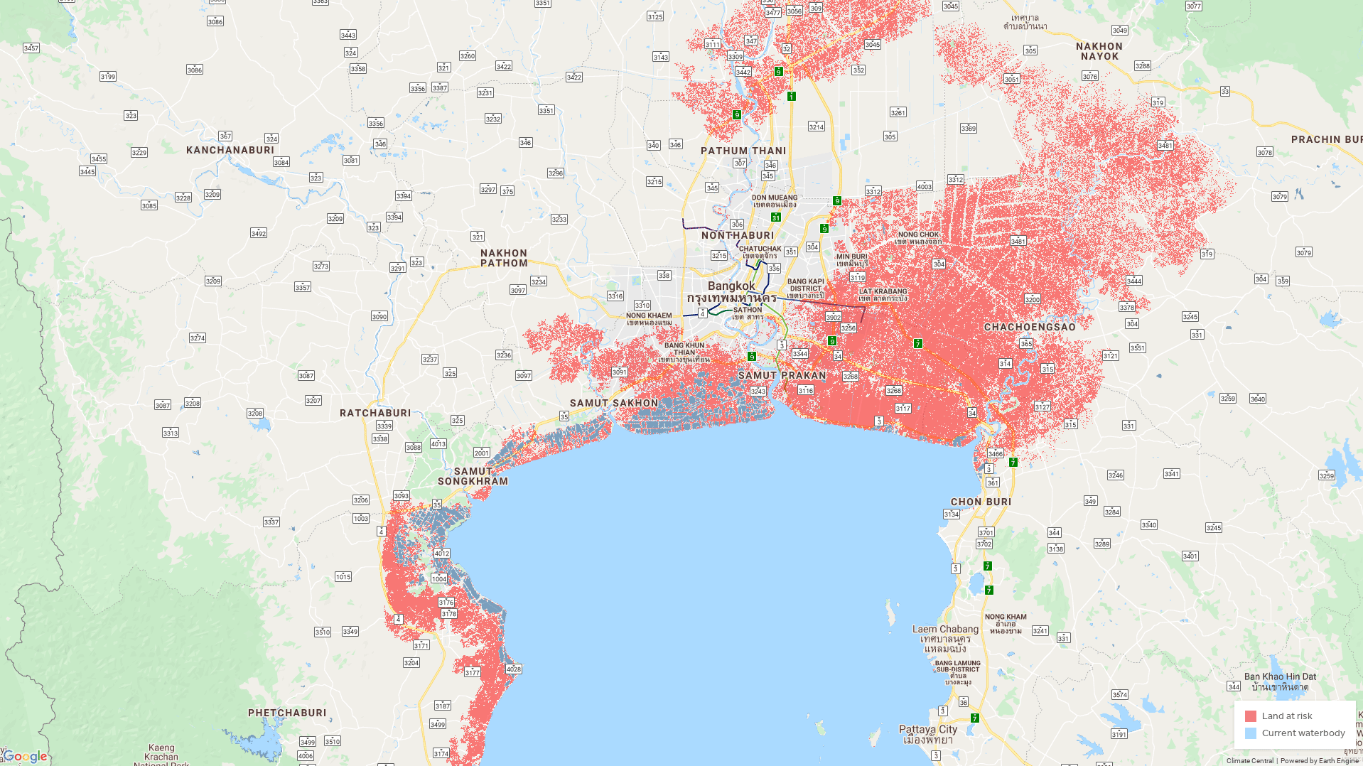
Culminating five years of painstaking work, our scientists published a new paper in Nature Communications. Based on an improved global elevation dataset we had developed using AI–CoastalDEM®–our research tripled previous population threat estimates. At the same time, Climate Central published the world’s first science-based interactive global sea-level-rise map online.
And we got the word out: according to independent data from Altmetric and Carbon Brief, our paper won more media and online attention than any other climate research published in a scientific journal from at least 2011-2021. More than 4,000 media stories covered our work in major outlets around the world, reaching at least 120 countries. United Nations Secretary-General António Guterres cited our research, and other world leaders took note. More than a million visitors used our online map within two months of launch.
And it has made a difference on the ground. Within three months of our map’s publication, the Hindustan Times reported that the Indian state of Maharashtra, home to Mumbai, approved its “first major plan to address sea level rise,” with the responsible agency stating it “has taken into account the study… from… Climate Central.” Our maps and data have been used for local climate communication campaigns in East Asia, tiger conservation in South Asia, and much more.
Meanwhile, Climate Central’s work proceeds. In September 2021, ahead of global climate talks in Glasgow, we released a major upgrade for CoastalDEM. We combined it with major new sea level projections from the Intergovernmental Panel on Climate Change published the month before. Together, these datasets make our maps the world’s best and only freely accessible tool for understanding local threats from sea level rise – worldwide.
Climate Central’s maps have also been integrated into En-ROADS, a climate policy simulator run by Climate Interactive and the Massachusetts Institute of Technology. “I use the Climate Central sea level rise maps in every En-ROADS event and briefing I do,” says John Sterman, a professor at MIT who helped create Climate Interactive. “I’ve done many of them, with groups ranging from MIT undergrads to members of Congress, ministers of finance in developing nations, CEOs and boards of large corporations and financial institutions. Very often the reaction to showing the results includes audible gasps.… The storm surge feature is particularly effective.”