
News•February 12, 2014
Northeast Braces for Latest Blast of Brutal Winter Weather

By Brian Kahn
As the latest blast of winter weather blankets the eastern U.S., winter storm warnings stretch from Mississippi to Vermont, alerting the millions of already winter-weary to another round of ice, sleet, snow and high winds headed their way.
The Southeast is already coated in a layer of ice, while the Mid-Atlantic and Northeast brace for wet snow and strong winds through Thursday. The storm is also expected to intensify.
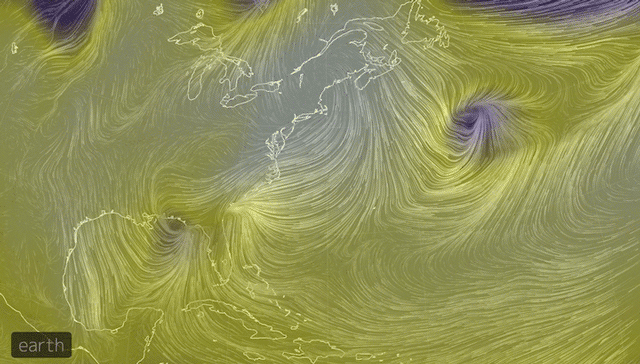
A map shows winds and sea level pressure as the storm currently bringing ice to the Southeast works it way up the East Coast from Wednesday night through Friday morning.
Credit: Earth
The system responsible for the warnings started dumping rain, snow, and ice on Tuesday in the Southeast and is behind the more than 375,000 power outages in Georgia and South Carolina, thanks to a layer of ice up to an inch thick covering the northeastern portion of the state. The governor of South Carolina has asked for the federal government to declare the entire state a disaster area.
Two weeks after 2 inches of snow wreaked havoc with Atlanta's traffic, the current icy and snowy conditions this storm is serving up have turned Raleigh, N.C.'s highways into parking lots on Wednesday afternoon.
If that wasn’t bad enough, the storm appears to be intensifying. The system will cross over to the Atlantic coast Wednesday evening and tap into the warm Gulf Stream current. At the same time, cold air flowing in from the Arctic will help the storm strengthen as it moves up the Eastern Seaboard.
That will translate to stronger winds, heavy bands of wet snow inland, and rain along the coast for an area that’s home to tens of millions of people. RELATEDWinter Storm of ‘Historic Proportions’ To Slam Southeast
January’s Temps Leave a Nation Blowing Hot and Cold
‘Atmospheric River’ May Put a Dent in California Drought
The first areas to deal with the reinvigorated storm will be Virginia and Maryland. Snowfall rates of 1-2 inches per hour are likely in Washington, D.C. and Baltimore and residents of those cities will likely wake up to 4-8 inches of snow on Thursday. Winds are also forecast to increase during the morning, gusting up to 35 mph for inland locations and 50 mph along the coast. That may help pile wet snow on tree branches and power lines, increasing the odds for power outages throughout the region.
Philadelphia and New York are also expect to get 4-8 inches of snow by midday Thursday and face similarly gusty conditions. Coastal areas will have to contend with mostly rain as warm air will likely keep temperatures slightly above freezing. Meanwhile, areas to the north and west of the cities are where more snow is expected Up to 18 inches are expected in the Hudson River Valley according to a Wednesday afternoon update from the NWS' Upton Office. Similar totals are also possible in the Appalachians and Poconos. The threat of heavy snow in the Appalachians has already caused the National Climatic Data Center, located in Asheville, N.C., to send home a number of its staff early.
The National Weather Service’s Upton, N.Y. office is warning that the amount of snow and its heavy nature could strain flat roofs in those areas and cause them to collapse as well as bring down trees and branches.
Gary Szatkowski, a meteorologist at the National Weather Service’s Mount Holly, N.J., office said that while what the Northeast will face is a “notch below” the ice storm that is coursing through the Southeast, the storm still has the potential leave people in the dark.
Strong winds off the coast will also drive 6-9 feet waves, upping the odds for beach erosion. Coastal flooding may also be a concern during high tide on Thursday and Friday mornings.
“It’s going to be hitting Baltimore and Washington, D.C., during Wednesday night, so travel will be treacherous during rush hour (Thursday morning),” Bruce Terry, a meteorologist with the National Weather Service, said. “This is likely to be the biggest storm here in the last 4 years.”
Both Maryland and Virginia have already declared a state of emergency, similar to the measures Georgia took before the ice storm started to affect the state.
It remains to be seen if the ice storm will break any records, but at least one could fall once the snow works its way north.
If 6 inches of snow falls in Philadelphia, it would mark the fourth time the city has received at least 6 inches of snow from a storm this winter. That would be the first time that’s happened since recordkeeping began in there in 1884. The city has also seen twice the average amount of snow this winter to-date.
New York has also seen roughly twice its average amount of snow to-date, but the city’s total of 28.3 inches through January is far below the record snowiest winter of 75.6 inches during 1995-96 and outside the top 10 snowiest winters.
And further south in the Mid-Atlantic, this winter has been about average in terms of snowfall to-date. At Reagan International in Washington, D.C., 8.1 inches of snow had fallen through January 31, on par with the average of 8.4 inches.
This winter has been colder than normal for much of the eastern U.S. Daily record-low temperatures outpaced record highs in January, and that trend has continued through early February. Overall, however, the number of frigid days in the U.S. has decreased markedly since the 1970s.
You May Also Like
Study Sounds ‘El Nino Alarm’ for Late This Year
White Roofs Could Offset Summer Warming by 2100
Winter Olympics Inadvertently Adapting to Climate Change