
News•May 8, 2014
Summer Blockbuster? El Niño Looking More Likely
It’s looking more and more certain that an El Niño is in the works and could arrive as soon as early summer — bringing with it warmer average global temperatures, fewer Atlantic hurricanes, and possible drought relief for the U.S. West — according to the latest forecast from the National Oceanic and Atmospheric Administration, released Thursday.
Animation of subsurface temperatures in the tropical Pacific Ocean.
Credit: NOAA.
The chance of an El Niño developing this summer has increased to 65 percent from 50 percent last month, and forecasters are now favoring an onset during the May-June-July time period, vs. the June-July-August favored in April’s outlook.
“The forecasters are much more optimistic that this is going to develop,” said Michelle L’Heureux, a meteorologist at NOAA’s Climate Prediction Center.
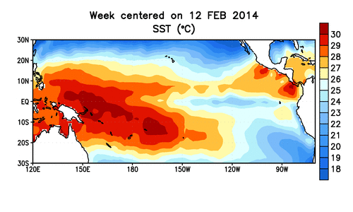
El Niño’s are part of a climate pattern known as the El Nino-Southern Oscillation (ENSO) and are characterized by warmer-than-average sea surface temperatures in the central and eastern tropical Pacific. (Their counterpart is called a La Niña and features cooler-than-normal conditions in the same area.) The state of the ENSO cycle is closely monitored because it can influence global temperatures and weather patterns around the world.RELATEDGet Ready for Next Climate Phenomenon: El Niño
Study Sounds ‘El Niño Alarm’ For Late This Year
Climate Change Could Double Likelihood of Super El Niños
An El Niño could push 2014 or 2015 to be a record warm year, as it is linked to higher average global temperatures. The 1997-1998 El Niño, one of the last major El Niño events, likely helped pushed 1998 to be one of the four warmest years on record, according to NOAA.
While a summer onset “actually wouldn’t mean a lot in terms of impacts in North America,” L’Heureux said, an El Niño could have significant impacts come fall and winter.
El Niño and La Niña events can help swing global average temperatures upward or downward with respect to their long-term average for a year or two. Typically, El Niño years are warmer than La Niña years. NOTE: This graphic uses data from NOAA, NASA GISS, and the U.K. Met Office.
In fact, drought-weary residents of California and the Southern Plains are hoping that a strong El Niño develops, as both areas historically see more winter precipitation during strong events. There are no guarantees, though, and there is still a large amount of uncertainty on how strong this potential El Niño event will turn out to be.
“We still are a little shy about saying anything about the intensity,” because there is still a large margin of error on the results coming out of climate models, L’Heureux told Climate Central.
Those margins will narrow some as the calendar progresses closer to the winter months — when most of the impacts of El Niño really emerge — but only some. “I wouldn’t want to rule out a major event at this point,” he said, but the intensity depends a lot on the instantaneous interactions between the ocean and the atmosphere, L’Heureux explained, so predicting it months in advance is problematic.
One of the main clues that forecasters are watching to gauge the likelihood of an El Niño developing is a plume of warm water below the ocean’s surface that has migrated from west to east across the tropical Pacific, a phenomenon called a Kelvin wave.
In ENSO-neutral conditions, when neither an El Niño nor a La Niña is in effect, easterly trade winds blow across the ocean, pushing water toward the western Pacific where it piles up. When those winds weaken, as they do during an El Niño, that lump of warm water slides “downhill” toward the eastern Pacific.
Forecasters watched a particularly warm Kelvin wave move across the ocean basin in March and April. The warmer waters were largely confined to the subsurface layers, though, with surface waters only beginning to warm within the last week.
“It’s really within the last week that we can say definitely that it has surfaced,” L’Heureux said.
Those surface temperature anomalies will continue to develop as the likely El Niño progresses, and “we’ll be watching those values like a hawk,” L’Heureux said.
Currently forecasters are sticking with an El Niño Watch, issued on March 6, and that means conditions are favorable for one to develop in the next six months.
Saying when exactly an El Niño has developed is tricky, because the phenomenon is clearest when looking at sea surface temperatures averaged over three months. To work around that, NOAA forecasters issue an El Niño Advisory (meaning El Niño conditions are in place or expected to continue) when three criteria are met. The first requires that the temperature anomaly in the surface waters exceeds 0.5°C (or 0.9°F). The second has to indicate that patterns of convection and winds are consistent with an El Niño, and the third that a three-month index of ocean temperatures will exceed the necessary threshold.
“I really do feel like all three are really essential,” L’Heureux said. “Ultimately, El Niño is about the three-month average.”
You May Also Like
John Allen: Scientist with an Eye on the Storm
U.S. Climate Change Report Warns of Regional Impacts
Climate Central at White House for NCA Launch
The Meteoric Rise of Carbon Dioxide in 1 Video