
News•May 7, 2014
John Allen: Scientist with an Eye on the Storm
By Kate Baggaley
“Have you seen a 5-inch hailstone?” asks John Allen. “Seeing a stone like that is pretty amazing. Seeing it fall? Pretty amazing. Being in Oklahoma, when there’s a Porsche dealership outside the gas station you’re hiding (in), and hearing the hailstones hit Porsches? Kinda fun.”
Allen, 27, is 6-foot-5 with reddish-brown hair and grey eyes behind rimless glasses. He leans forward, gesturing gracefully as he speaks, fingers rotating and pulling the air to illustrate his favorite subject: severe weather. It is a subject that has enthralled him since childhood, and enticed him to move from his native Australia; the United States, with its tumultuous weather, is the ideal location for severe storm research.
Behind Allen, sunlight streams through the lobby windows of the International Research Institute for Climate and Society in Palisades, north of New York City. The only break in the placid scene is the jarring photograph of forked lightning on his laptop screen, a picture Allen took the first time he brought his wife storm chasing with him in Australia.
When he’s not researching tornado prediction and climate change, Allen drives 10,000 miles a year chasing storms across America’s Great Plains, home of the world’s strongest and most numerous tornadoes. “In Australia it’s a little bit benign,” Allen says. “There’s a lot more power (in the U.S.). You have a lot more respect for what the atmosphere can do here.” His work tries to make order of a swirl of day-to-day forecasting, the larger-scale fluctuations of climate, the excitement of storm chasing and the exactitude of science.
The western suburbs of Sydney, where Allen grew up, are prone to hailstorms. In the early 1990s, storms rained 3-inch hail on houses and cars. “I’d go outside and measure the hailstone after they fell,” he says. Once, “I actually went out during the hail storm, which promptly got me yanked back inside.”
A supercell drops rain over farmland in Oklahoma, 2012.
Credit: John Allen

As a teenager, he drove into the country in search of storms with his Minolta camera. He began chasing more seriously after meeting fellow storm chaser Brad Hannon on a hilltop during a lightning storm in Melbourne.
“[John] and I chase very well together,” Hannon says. “I’m better at driving on the chase, and John’s very good at navigating and interpreting data on the fly.”
In college, Allen’s interest in meteorology blossomed into a career. He earned his PhD in meteorology at the University of Melbourne, studying how climate change will impact severe weather in Australia.
“He’s got this combination of excellent observational skills from taking photographs (and) understanding of the day-to-day severe weather . . . but also the understanding of the larger-scale climate variations,” says David Karoly, his academic advisor at Melbourne. “Most people work on either the climate or they work on severe weather – but not on combining the two.”
Allen came to the U.S. for a post-doctoral position at Columbia University, joining prediction specialist Michael Tippett to develop a seasonal tornado forecast. Allen’s suited for the work because he has both scientific and practical knowledge, says Tippett. “That's really an important part of our work, having someone who can provide that.”
The tornado forecasts they’re developing are based on environmental conditions associated with tornadoes and hail. They focus especially on assessing the rain potential of storm clouds and on wind shear — the sometimes-chaotic variation in the direction and speed of wind at various heights.
Storm chasers learn to take close calls in stride. Once, south of La Junta, Colo., both of John Allen’s back tires blew out as a tornado bore down. No one stopped to offer a ride. Fortunately, the tornado lifted before reaching his car.
Credit: Brad Hannon

Currently, the federal government’s Storm Prediction Center forecasts the likely locations of severe weather events five to eight days in advance. Allen wants to make predictions reliable at least a month out. We already have seasonal predictions for other weather events, like rainfall or hurricanes, he says. “What if we could know that May is going to be an incredibly hectic month?”
Though the predictions Allen is working on are promising, they’re not yet reliable, in part because he hasn’t been issuing them long enough to have an assessable track record. “One of the big challenges is getting a long enough dataset we can evaluate it on,” says Harold Brooks, a meteorologist at the National Severe Storms Laboratory in Norman, Okla. “We've got a bunch of questions (such as) does it work better some times of the year than others?”
The need for reliable longer-term forecasts is more urgent than ever, as some elements of severe weather become more common with climate change and a growing population moves into more storm-prone areas. Reliable tornado prediction is especially important in the Great Plains states, where the tumultuous weather has awed Allen since his first storm-chasing trip in the U.S. in 2010.
“The absolute power of watching a storm go from nothing to a tower 60,000 feet into the air, and producing no hail to baseballs inside 10 minutes is mind-blowing,” he says.
It’s hard to return to working at a computer after that. “It inspires me, though, because I’ll see something out in the field . . . and it’ll start me onto another research path,” Allen says. “Sometimes taking a step out is actually the best thing you could possibly do for your research.”
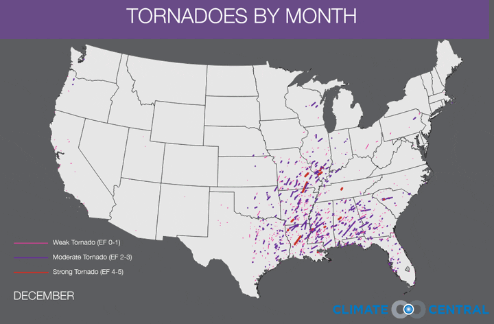
An animation showing every tornado recorded from 1950-2012 by month.
Data via NOAA Storm Prediction Center.
Storm chasers are a diverse lot, encompassing thrill seekers, researchers collecting data, and people who just want to glimpse some of the planet’s most extreme weather. What draws him, Allen says, is “the fact that a structure can exist in the sky, built out of cloud, that looks incredibly organized, and yet the whole system is completely chaotic.”
Yet the other side of this beautiful chaos is the obliteration storms cause, which every storm chaser must wrestle with. “You see this storm start to form into the most diabolical tornado,” he says, and, “you realize you’re powerless to stop it . . . and you know that people are going to die.”
Allen has seen the destruction up close. Near Piedmont, Okla., in 2011, pink chunks of insulation, 2-by-4s, and a Barbie doll fell from the sky around his car. He saw the vast “column of nothing” left in the nearby town of Moore last year. And in Grove, also in Oklahoma, while avoiding the 2011 tornado that plowed through Joplin, Mo., he found a trailer that had been tossed 400 yards and splayed open, its carriage ripped out. Through the shredded trees he glimpsed boots, a piece of couch, a chair.
“Seeing things like that really makes you realize how much damage these things are doing,” he says. “They’re tearing up someone’s life.”
Allen takes measures to minimize the risks. He plans escape routes, doesn’t over-rely on radar, and avoids crowded metropolitan areas where projectiles and panicked drivers multiply. Finally, he keeps his distance from funnel clouds – 1 to 3 miles or more, depending on how fast and volatile the storm.
“It scares the living heck out of me when I see people (who) don’t treat the storm with respect,” he says. “There are some people who do it in a very dangerous fashion.”
One of the victims of the enormous tornado that hit El Reno, Okla., last spring was a man who tried to get a closer look but had no experience with storms. “He was literally an amateur who’d never seen a storm before in his life,” says Allen. “He went out and took a picture with his cellphone and was dead 10 minutes later.”
The safest way for amateurs to get involved, Allen says, is to join an experienced chaser or even a storm chasing tour group, most of which drive very safely and don’t get too close.
“What’s a better situation: a person who has no idea what they’re doing going out and chasing a storm,” Allen says, “or someone with a group of people that has a professional forecaster (and) a professional driver used to driving in severe weather conditions who can keep them safe?”
Storm clouds gather near El Reno, Okla., May, 2013.
Credit: John Allen

None of those steps eliminates risk, even for a skilled chaser like Allen. Once, while setting up his camera, Allen felt static in the air and dropped to the ground moments before a lightning bolt crashed 20 yards up the road (“I’m a bit of a lightning rod,” he says). Another time, he drove right through a weak tornado to avoid the 3-inch hailstones raining next to it.
And last spring, in El Reno, Allen and his wife, Rose, found themselves in the path of the storm that spawned a 2.6 mile-wide tornado. The May 31 storm unexpectedly accelerated from 25 mph to nearly 60 mph and changed direction. Three experienced storm-chasing researchers died, the first ever killed by a tornado; a Weather Channel vehicle was thrown 200 yards, injuring the crew.
“We ended up about a mile off that monster tornado with 318 mph winds racing behind us,” Allen says. As the storm moved toward Oklahoma City, he and his wife became gridlocked among thousands who’d fled. Luckily, the tornado collapsed and the storm eased before reaching them.
Tornadoes like El Reno, while harrowing, won’t stop Allen from riding into the field armed with camera, maps, and a first-aid kit. He doesn’t want to give up the warm, moist smell rolling off the cornfields as a storm draws in air, or winds too strong to stand in, or the cannons of thunder and waterfall roar of an approaching tornado, or the feeling in the air, charged and humid. “The atmosphere is almost primed,” says Allen. “It feels like something’s about to explode.”
Soon, Allen hopes to bring his research into the field by using sounding balloons to collect data on how storms transform the surrounding air. “People think I’m a bit of a weather weenie,” he says. “I happily take that term.”
Kate Baggaley is a science writer based in New York City and a recent graduate of New York University's Science, Health and Environmental Reporting Program. You can find more of her work at katebaggaley.com or follow her on Twitter at @kate_baggaley.