
News•June 5, 2014
No El Niño Yet, Still Expected This Summer
Sorry, El Niño watchers, but the climate phenomenon we’ve all been waiting for still hasn’t officially arrived. But forecasters still expect it to emerge this summer, and if it does, it is expected to affect weather around the world.
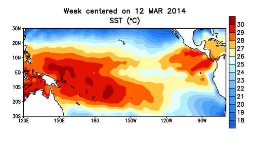
Animation of sea surface temperatures in the tropical Pacific Ocean.
Credit: NOAA.
The Climate Prediction Center, part of the National Oceanic and Atmospheric Administration, issued its latest monthly outlook on the state of the El Niño-Southern Oscillation (or ENSO, the name for the broader phenomenon) on Thursday, with little change from last month’s update. The only differences were a slight increase in the probability that El Niño will be in place this summer, and a tentative guess at how strong that El Niño might turn out to be.
“There’s no big game changer there,” said Michelle L’Heureux, a CPC meteorologist who helps put together the outlooks.
El Niño is the part of the ENSO cycle characterized by warmer-than-average sea surface temperatures in the central and eastern tropical Pacific. (Its counterpart, La Niña, is characterized by colder-than-average temperatures in the same region.)
Everyone from hurricane forecasters to drought-weary farmers in California is closely watching the El Niño updates because those temperature perturbations influence oceanic and atmospheric patterns, in turn affecting the weather in particular regions around the globe. For example, El Niños tend to tamp down on hurricane formation and growth in the Atlantic Ocean basin, while typically bringing rainy winters to California, which is sorely in need of some rain. El Niño could even push 2014 or 2015 to be a record warm year.RELATEDSummer Blockbuster? El Niño Looking More Likely
El Niño Expected to Limit 2014 Hurricane Season
Climate Change Could Double Likelihood of Super El Niños
The latest CPC update puts the chance of having an El Niño this summer at 70 percent and increasing to 80 percent for fall and winter. The previous update put the summer chances at “exceeding 65 percent” and the fall chances just under 80 percent.
Three main criteria are used to declare an El Niño Advisory, the CPC’s term for when El Niño conditions have been observed or are expected to continue. The first is that the sea surface temperatures in a particular part of the equatorial Pacific must be 0.5°C (0.9°F) above normal. Right now, that temperature is flirting with that mark.
“We’re hovering on the cusp,” L’Heureux told Climate Central.
Second, because El Niño conditions develop slowly, they’re best recognized by averaging that temperature difference over the previous three months, a measure called the Oceanic Niño Index (ONI). To avoid having to wait to declare an El Niño, L’Heureux and her colleagues will issue an advisory when they expect that the ONI will surpass the 0.5°C threshold.
Thirdly, because “El Niño is both the ocean and the atmosphere,” forecasters look for particular atmospheric conditions to indicate an El Niño is in play. So far this year, though, “the atmospheric response has been rather lackluster,” L’Heureux said.
She said forecasters are still waiting to see key features, such as enhanced convection, particularly in the western tropical Pacific, as well as drier air over Indonesia.
Another measure that can be used to help tell if an El Niño is in place, called the Southern Oscillation Index, has been trending in the wrong direction. The index is calculated using the pressure differences between Tahiti and Darwin, Australia.
“There’s just a lot of little things that we’re not particularly impressed by,” L’Heureux said.
Despite these little signs that are lagging behind, forecasters are fairly confident an El Niño will indeed emerge this summer, though they are much less certain how strong it will be. Stronger El Niños are better correlated to weather impacts, making many anxious to know what they’re going to get.
When a pulse of very warm water flowed from the west to the east tropical Pacific earlier this spring, many comparisons were made to the strong El Niño event of 1997-1998. But since then “we’ve seen the total kind of heat storage of the tropical Pacific go down,” L’Heureux said. The dissipation was expected, but “the heat content is not keeping pace with ’97-’98,” L’Heureux said.
Right now, the models the team runs are suggesting a moderate-strength El Niño for this fall, though the model results show considerable variation, L’Heureux said, adding, “let me emphasize how low confidence this [strength] forecast is.”
So L’Heureux must wait like everyone else to see how the situation develops and if all the factors that influence El Niño will fall in line.
“We still think there’s a nice heat supply, and we’re just kind of waiting on the atmosphere to kick in,” she said.
You May Also Like
The Ocean is Heating Up for Hurricane Season
How Will We Know When El Niño Finally Arrives?
Here’s How Much U.S. Summers Have Warmed Since 1970
EPA Aims To Slash Power Plant CO2 by 30 Percent